Creating a regional open space plan for Cape Cod
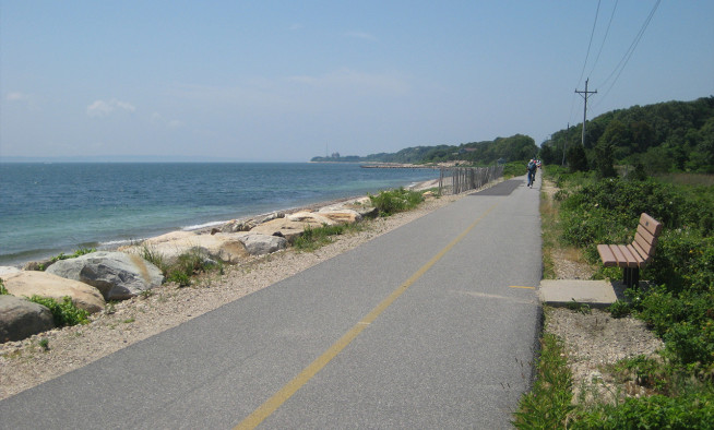
Cape Cod’s beaches, woodlands, and marshes are more than scenic landscapes. They are essential to the region’s drinking water, wildlife habitat, and economy. To help ensure these resources are protected for generations to come, the Cape Cod Commission is developing a regional open space plan.
The 2025 Regional Policy Plan (RPP) establishes a goal to conserve, preserve, and enhance a connected network of open space that supports the Cape’s natural systems and community character. It also includes a recommended action to develop a regional open space plan to identify lands of natural and community significance for protection.
While Cape Cod has a strong conservation track record, with approximately 40 percent of the region’s more than 230,000 acres already protected by federal, state, and local governments as well as private land trusts, much of the remaining land is either developed or facing increasing pressure. Opportunities for conservation are becoming increasingly limited, making it especially important to take a strategic, coordinated approach to future protection efforts.
Open space plays a vital role across the region in ways that are not always immediately visible. Natural landscapes help filter and protect the groundwater that supplies the Cape’s drinking water, provide essential habitat for a wide range of plant and animal species, and support the region’s economy by sustaining recreation, tourism, and other resource-based industries. Forests, wetlands, and soils also act as carbon sinks, storing carbon that might otherwise be released by development while continuing to absorb carbon from the atmosphere.
The regional open space plan will help identify and prioritize the lands most important to protect for natural resource conservation, community values, and long-term resilience. It will also focus on improving connections between existing open spaces to create a more cohesive and functional regional network. As part of this effort, the Cape Cod Commission will conduct data collection and analysis, develop open space profiles for Barnstable County and all fifteen Cape Cod towns, map and analyze undeveloped and unprotected lands, and examine the economic value of open space across the region.
The plan will build on previous local and regional efforts, including municipal open space and recreation plans and land trust prioritization strategies, and will be designed to align with Massachusetts’ Biodiversity Conservation Goals, which emphasize land protection, habitat restoration, sustainable food systems, and strengthening connections between people and the natural environment.
Public engagement will be an important part of the planning process. The Commission will work with municipal officials, land trusts, and other stakeholders, while also seeking input from the broader community through surveys and public meetings. Local knowledge and community priorities will play a key role in shaping the final plan.
The regional open space plan will provide a roadmap for protecting the Cape’s most important landscapes while balancing the need for future development and infrastructure. Through a thoughtful and coordinated approach, the plan aims to ensure that Cape Cod’s natural resources, community character, and environmental resilience are sustained for generations to come.
Related Posts