Category: Newsletter
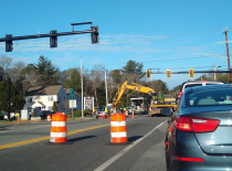
The Metropolitan Planning Organization on Monday released the draft FFY 2027-2031 Transportation Improvement Program, a five-year plan for transportation spending across the region. Read on to discover some of the projects included in this year's plan.

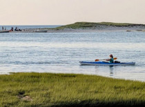
Bicycling is central to life on Cape Cod, with riders of all types using the region’s scenic roads and off-road paths year-round. Vision 88 aims to create a continuous 88-mile shared-use path from Woods Hole to Provincetown. Recent investments have expanded the trail network, with more segments in design. The Cape Cod Commission’s draft 2027 Unified Planning Work Program includes efforts to advance Vision 88 through data collection, regional coordination, and public engagement, including a project inventory, online feedback tool, and outreach campaign.
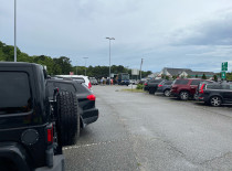
By sunrise most mornings, Barnstable’s Route 132 park-and-ride lot is already overflowing with commuters and travelers headed for Boston, Logan Airport, and other destinations. The Route 132 park-and-ride and the spaces available at the Hyannis Transportation Center are the only park-and-ride facilities offering direct service to Boston from the mid-Cape area. MassDOT has dedicated funding this year to complete a major redesign of the facility. The final design expands the lot to the north and west, adding 271 new parking spaces for a total of 639 total parking spaces, nearly double the current capacity.
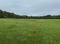
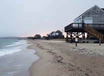
Cape Cod’s beaches, woodlands, and marshes are more than scenic landscapes. They are essential to the region’s drinking water, wildlife habitat, and economy. To help ensure these resources are protected for generations to come, the Cape Cod Commission is developing a regional open space plan. The 2025 Regional Policy Plan (RPP) establishes a goal to conserve, preserve, and enhance a connected network of open space that supports the Cape’s natural systems and community character. It also includes a recommended action to develop a regional open space plan to identify lands of natural and community significance for protection.
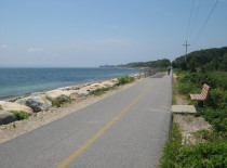
This year, Falmouth's Shining Sea Bikeway is celebrating its 50th anniversary. A summer of events to commemorate this anniversary kicked off on April 25, which Falmouth selectmen designated as Shining Sea Bikeway Day. Spring and summer events include community rides, live music, local food, and a season-long 50-mile challenge.

A status on projects currently under review by the Cape Cod Commission.

Cape Cod remains in a Level 2 (Significant) drought, according to the most recent designation from the state’s drought management task force. The declaration, issued in April based on March data, reflects ongoing conditions across the region and much of Massachusetts. Residents are encouraged to conserve water during this period of drought.
The Town of Yarmouth recently presented its Local Comprehensive Plan (LCP) to the Cape Cod Commission for certification, outlining a long-term vision to guide growth, protect natural resources, and strengthen the community over the next decade and beyond.
Commission staff are partnering with the Pleasant Bay Alliance towns of Chatham, Harwich, and Orleans to implement a model coastal resilience bylaw and its accompanying regulations. Staff are collaborating with local officials in each town to adapt the model bylaw and regulations to meet specific local needs.
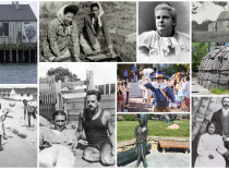
Women's history on Cape Cod is marked by resilience and leadership, with women playing pivotal roles in shaping the region’s communities since its early settlement. In the 19th century, while many men were away at sea, women managed households, farms, and local businesses, becoming the backbone of Cape Cod’s coastal villages. As educators, abolitionists, and suffragists, Cape Cod women like Mercy Otis Warren and Helen Augusta Crocker advocated for social change. During the 20th century, women continued to lead, from environmental conservation efforts to local politics. Today, women continue to be vital leaders in the region’s civic, cultural, and environmental spheres.
