-
Overview
-
Português
Overview
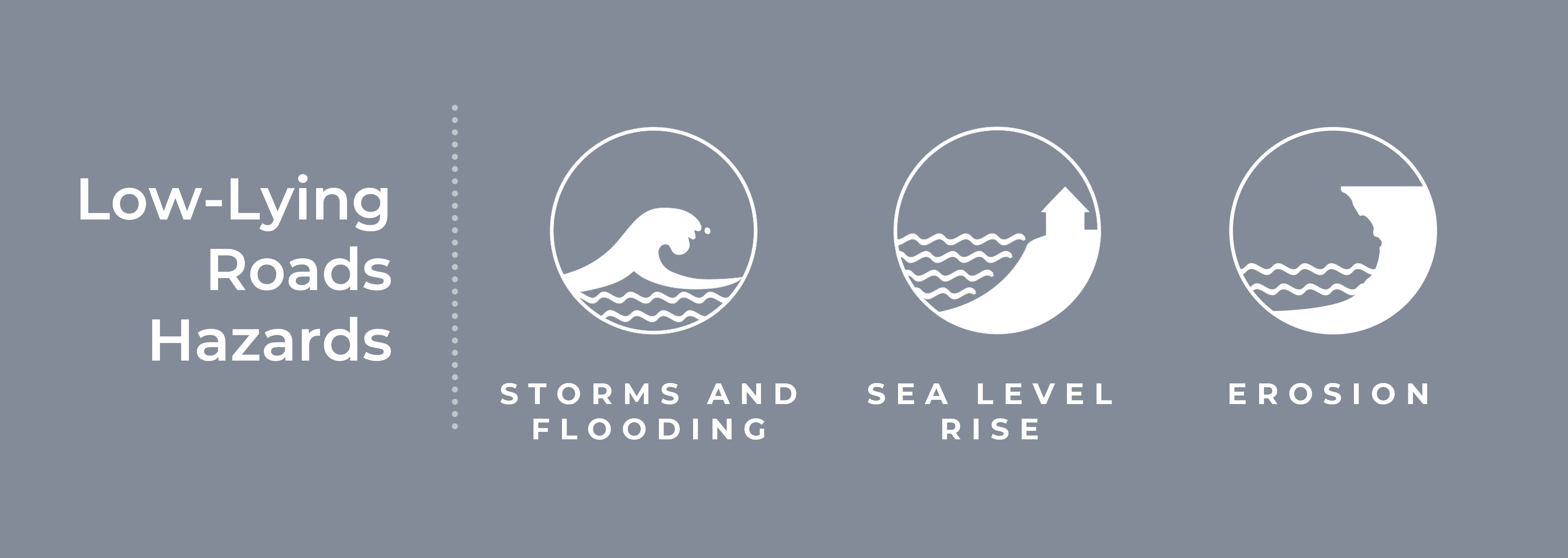
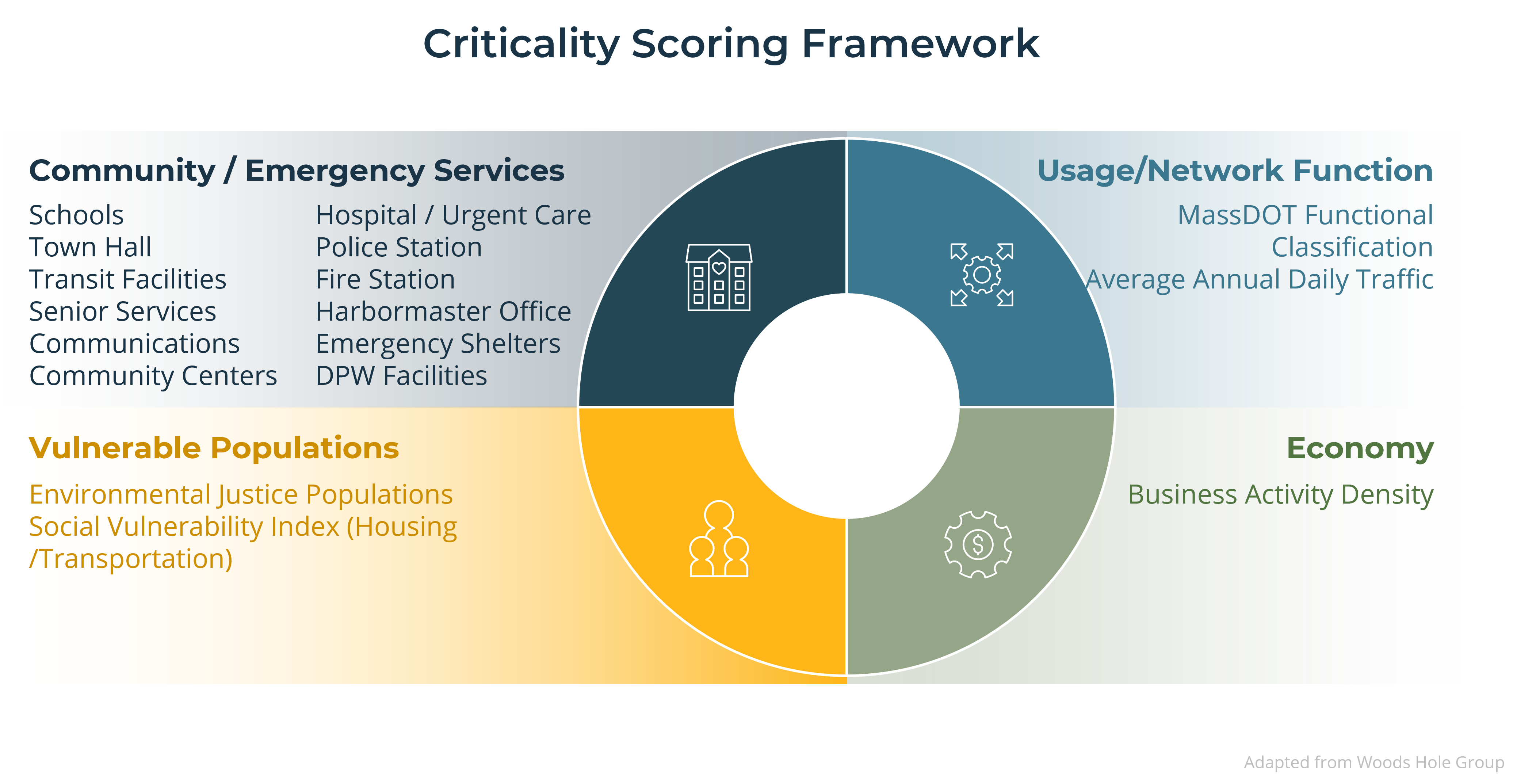
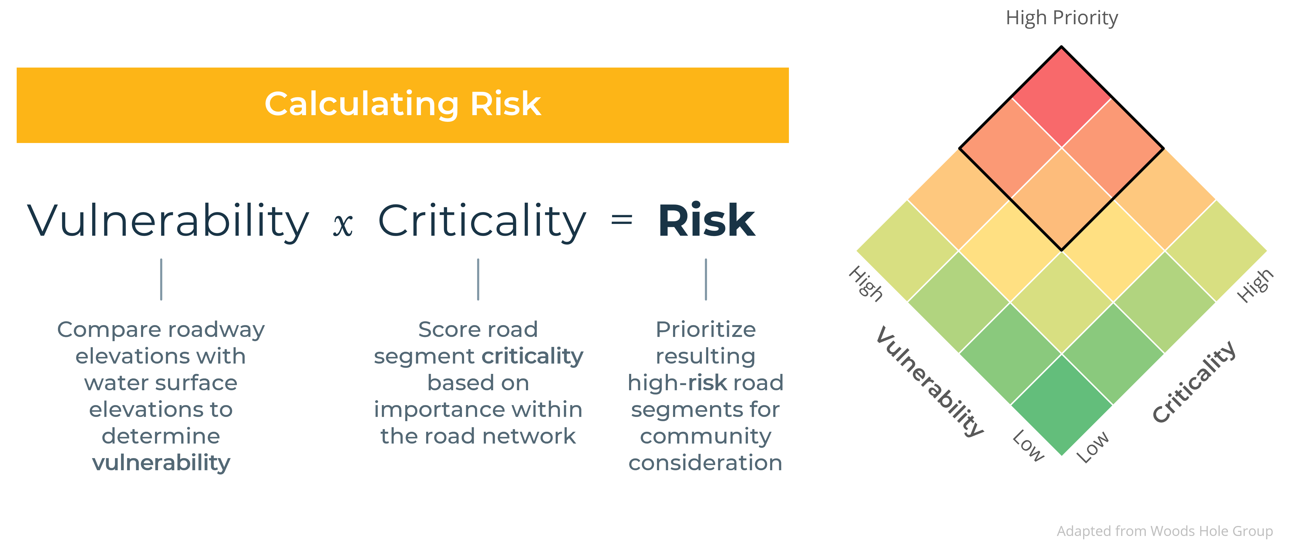
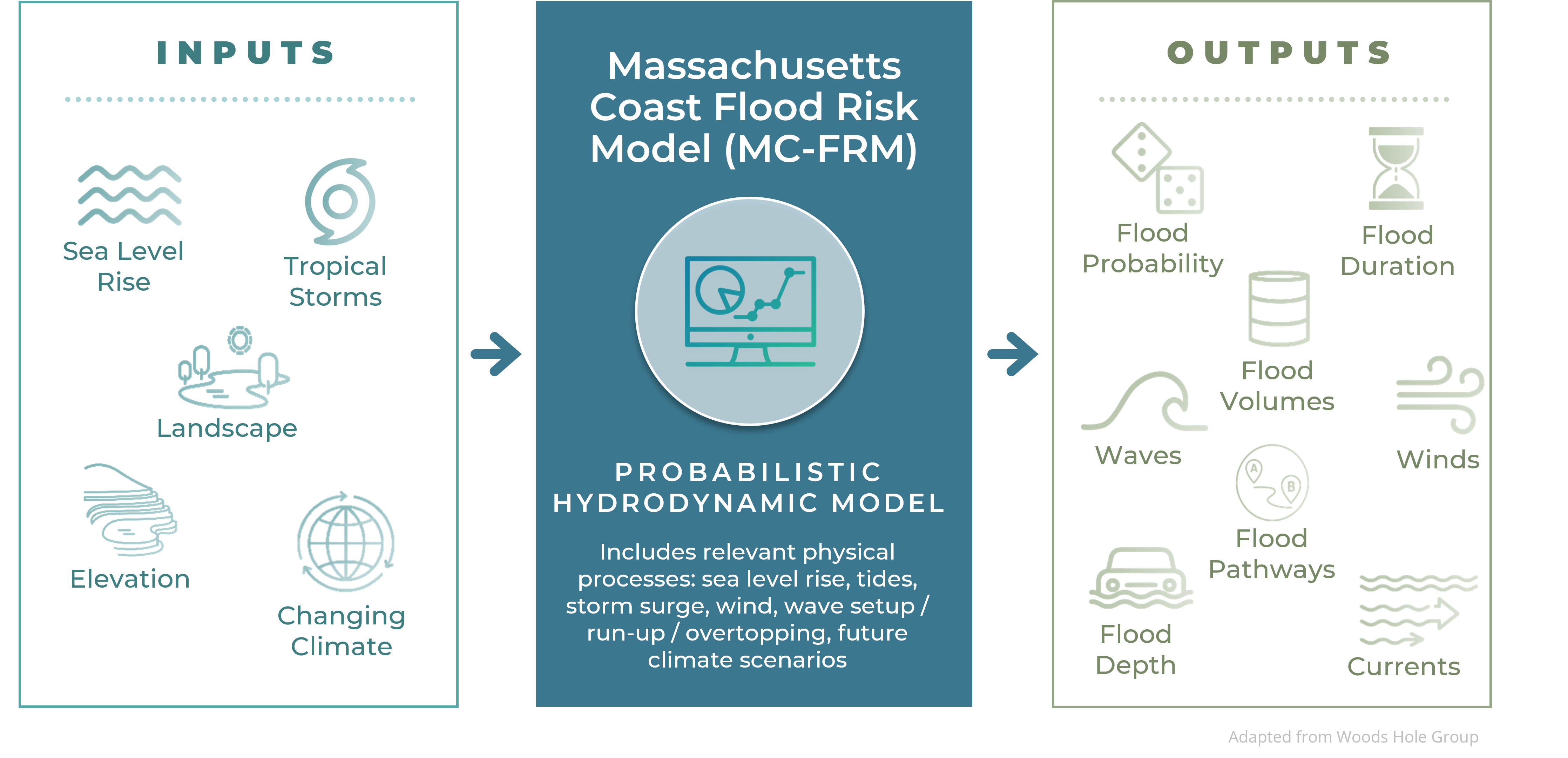
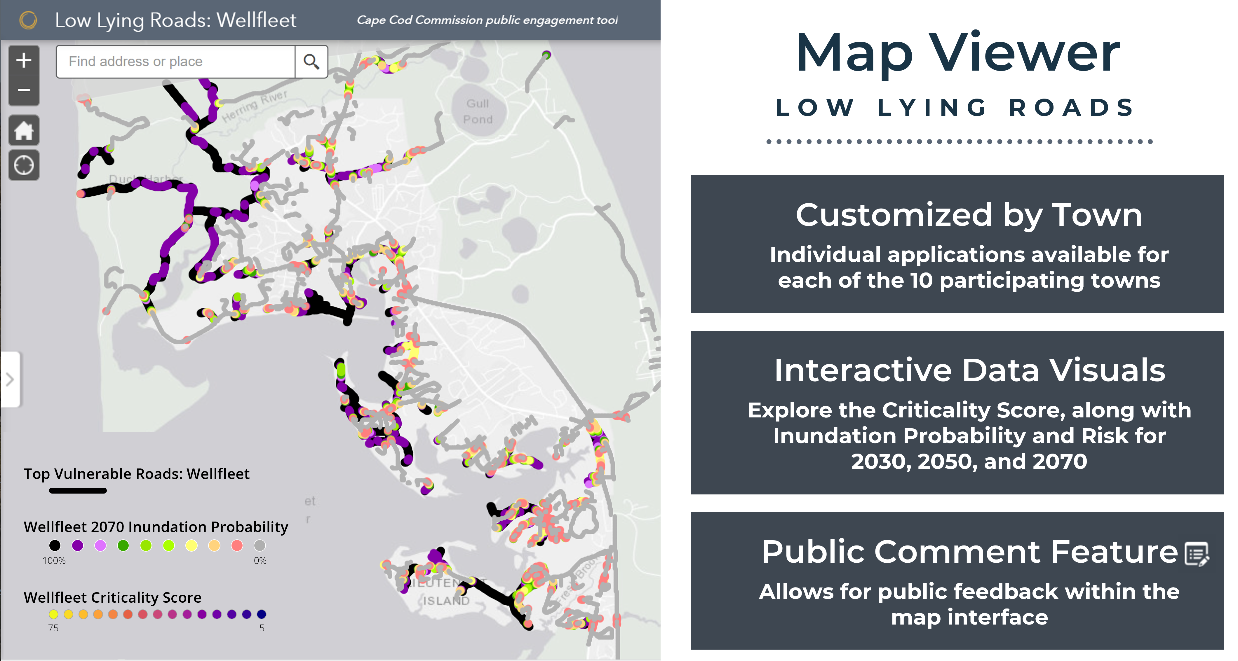
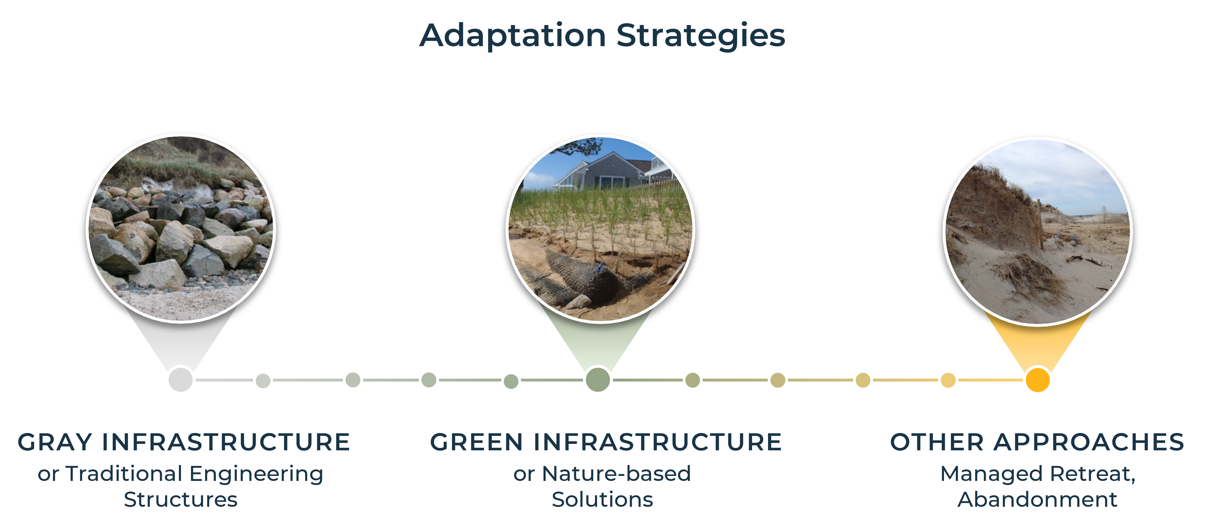
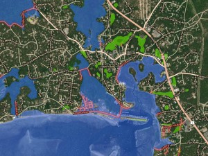
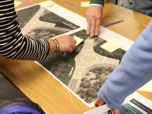
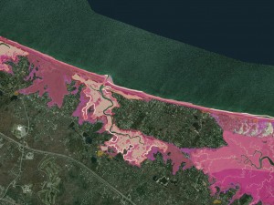
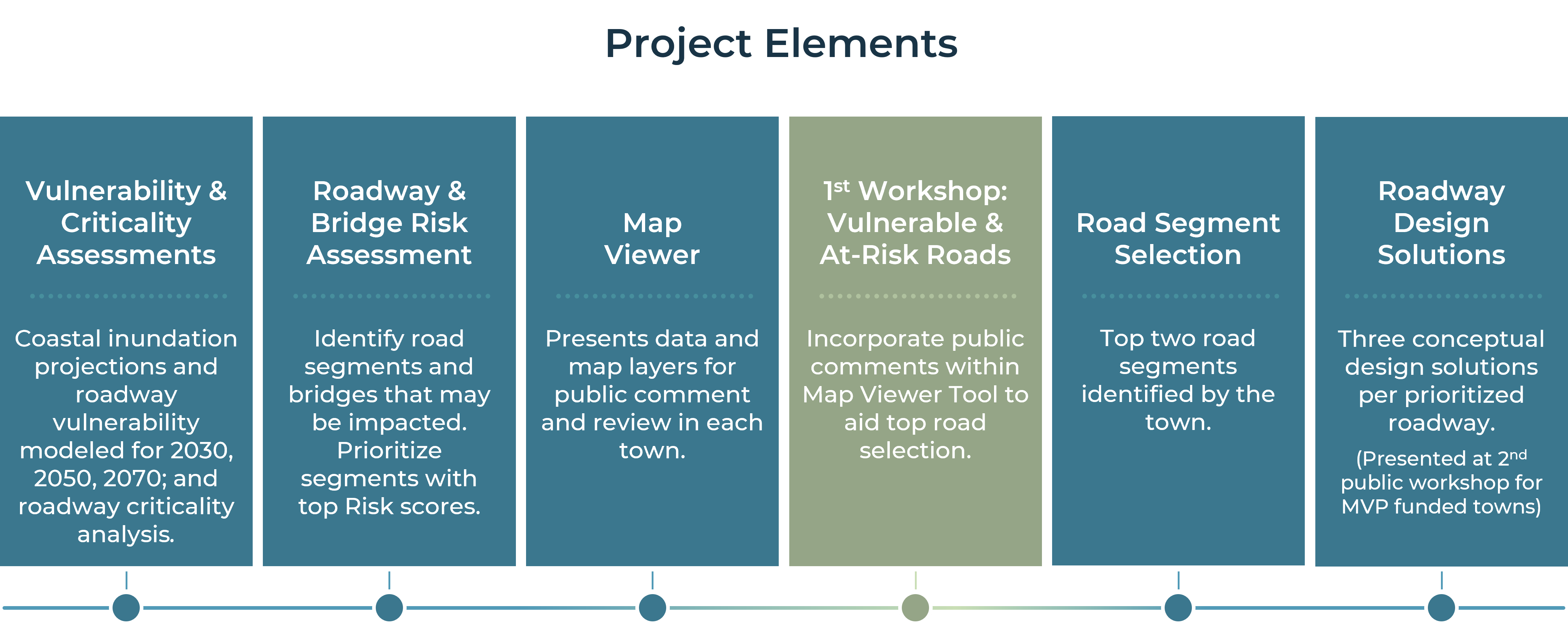
Cape Cod Commission staff worked with all 15 towns to examine vulnerabilities in the roadway network and identify adaptation alternatives. With funding support from the U.S. Economic Development Administration and the Massachusetts Municipal Vulnerability Preparedness program, the Commission contracted with the Woods Hole Group to conduct a vulnerability assessment of roadway segments, bridges, and culverts due to flooding from the combined effects of sea level rise and storm surge. The project employs state of the art modeling and community engagement to identify and prioritize low lying roads to target for coastal resiliency action.
The project kicked-off in September 2021 and concluded in June 2024. The towns of Barnstable, Bourne, Brewster, Dennis, Eastham, Orleans, Sandwich, Wellfleet, Truro, and Yarmouth were the first towns to undergo the modeling and analysis, and receive design solutions for two road segments, concluding in Spring 2023. Modeling and analysis for the remaining towns of Chatham, Falmouth, Mashpee, Harwich, and Provincetown are currently underway, and workshops were held in Spring 2023. Work under this second MVP Action grant concluded in June 2024.
Explore the tabs below to learn about the project elements and process. Scroll to the bottom of this page and click on the individual town buttons to access detailed information and project materials. Links for the remaining towns will be added as information becomes available.
Visão Global
Os funcionários do Cape Cod Commission estão trabalhando com todas as 15 cidades para examinar as vulnerabilidades nas redes de estradas e identificar as adaptações alternativas. Com o suporte recebido através dos fundos da U.S. Economic Development Administration (Administração de Desenvolvimento Econômico dos Estados Unidos) e do Massachusetts Municipal Vulnerability Preparedness program (Programa Municipal de Preparação para Vulnerabilidade do Estado de Massachusetts), o Comitê contratou o grupo Woods Hole para conduzir a avaliação da vulnerabilidade das estradas, pontes e bueiros devido as enchentes provocadas pela combinação dos efeitos causados pelo nível do mar e tempestades, O projeto emprega modelo de última geração e engajameto comunitário pra identificar e priorizar as estradas baixas para ter como alvo a ação de resiliência coastal.
O projeto teve início em setembro de 2021 e sua conclusão está programada para junho de 2024. As cidades de Barnstable, Bourne, Brewster, Dennis, Eastham, Orleans, Sandwich, Wellfleet, Truto e Yarmouth foram as primeiras cidades a serem submetidas ao modelo e análises, e receberem solucões de design para duas estradas, concluindo em 2023. Modelo e análises para as cidades restantes, Chatham, Falmouth, Mashpee, Harwich, Provincetown estão em andamento e workshops estão marcados para a primavera de 2023. Trabalhos sob esta segunda ação de fundos MVP serão concluídos em junho de 2024.
Explore as abas abaixo para aprender sobre os elementos e o processo do projeto. Deslize a página para baixo e clique nos botões das cidades específicas para acessar informações detalhadas e materiais do projeto. Links para as cidades restantes serão adicionados assim que as informações estiverem disponíveis.
Se houver necessidade de serviços de intérprete, favor entrar em contato com Martha Hevenor por email: mhevenor@capecodcommission.org, ou através do telefone (508) 744-1213.