Regulating for a Resilient Coast
Flexible, adaptable, and compatible regulations designed to protect wetland resources and property now and into the future.
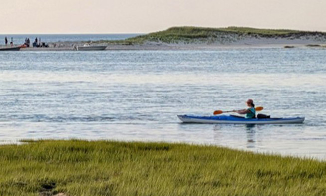
Coastal wetlands are vital to Cape Cod, supporting biodiversity, recreation, and natural flood protection by buffering waves, storm surges, and heavy rainfall. However, the dynamic nature of shoreline features like beaches, marshes, and dunes means they are constantly shifting. Infrastructure such as seawalls or homes built too close to these resources can worsen erosion, amplify flood damage, and threaten natural and built environments.
Traditionally, flood protection measures have relied on Federal Emergency Management Agency (FEMA) Flood Insurance Rate Maps (FIRM), which are based on historical flood data. These maps do not account for predicted rising sea levels and more intense storms, leaving communities increasingly vulnerable. To help mitigate these risks, there is a crucial need to manage development in flood-prone areas now and in the future. Enhanced regulations can provide additional protection for sensitive natural resource areas, along with property and infrastructure.
In response, the Cape Cod Commission has developed a set of model wetlands and zoning regulations to mitigate and adapt to coastal changes. These new regulations build upon the existing coastal resilience bylaw and set higher standards for zoning regulations than those required by FEMA’s National Flood Insurance Program. They also create cohesive local regulations and permitting across various boards and commissions.
Designed with flexibility and adaptability in mind, these model regulations allow towns to select a planning horizon based on the best available data and tailor the bylaw language to fit local priorities. This approach ensures that each community can implement coastal protection measures that are both effective and responsive to its unique needs while also aligning with broader regulatory frameworks.
This work was funded by a Massachusetts Executive Office of Energy and Environmental Affairs Planning Assistance Grant and created in partnership with the Cape Cod Cooperative Extension, Woods Hole Sea Grant, Urban Harbors Institute, Noble, Wickersham, and Heart, and the towns of Chatham, Eastham, Provincetown, Truro, and Wellfleet.
Learn more: www.capecodcommission.org/coastal-floodplain-resiliency
Related Posts