- Background
- The Study
- Key Takeaways
Background
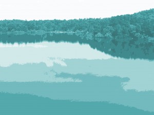
Water clarity, or the ability of light to pass through water, is an indicator and regulator of biological and ecological function in freshwater ponds. Secchi disk depth measures the clarity of the water column as viewed by an observer. It has been widely used in the field to measure water clarity for over 200 ponds across Cape Cod since 2001. Water clarity can provide insight into the health of Cape Cod’s freshwater ponds as water clarity is influenced by factors such as nutrients and algal growth.
While there is a significant amount of water clarity data available from historical and ongoing Secchi disk observations, data collection requires pond access, equipment, and labor. Satellite remote sensing is an established tool for monitoring water clarity, offering frequent and regular data collection, standardized processes, and uniform observations of many ponds. On Cape Cod, satellite remote sensing can complement traditional water clarity monitoring to improve spatial and temporal coverage of water clarity estimates while reducing costs and manual sampling labor. Future projects will further explore how remote sensing can help us understand pond health.
The Study
National Oceanic and Atmospheric Administration partnership
The Cape Cod Commission, in partnership with the National Oceanic and Atmospheric Administration (NOAA), conducted a study to develop a framework for assessing water clarity for Cape Cod ponds using satellite reflectance data. The study combined existing field-measured Secchi disk depth data, field-measured maximum pond depths, and satellite reflectance data to derive satellite-estimated Secchi disk depths for 193 Cape Cod ponds. Using satellite imagery from the joint NASA/USGS Landsat Program, water clarity estimates were generated for ponds in the study as far back as 1984, allowing for a nearly 20-year time series to be analyzed.
Full details of the study are contained in Satellite imagery as a management tool for monitoring water clarity across freshwater ponds on Cape Cod, Massachusetts, published in the Journal of Environmental Management.
Southeast New England Program funded work
Working with project partners at the University of Minnesota, University of Rhode Island (URI) Watershed Watch, and the Association to Preserve Cape Cod, the Commission will collect and analyze field data to correlate observations from satellite imagery with measured water quality data. This work is funded by a $298,527 Southeast New England Program (SNEP) Priority Research Grant.
The University of Minnesota has partnered with the Cape Cod Commission to create a model for estimating coastal lake and pond water quality and clarity in the SNEP region using satellite imagery. The Association to Preserve Cape Cod (APCC) has partnered with the Cape Cod Commission to manage collection of field data on Cape Cod that will be used to develop the model and provide guidance on analysis and data products. URI Watershed Watch is sharing data from their ongoing monitoring of over 60 lakes and ponds throughout Rhode Island and Southeastern Massachusetts to improve model development.
The three-year project began in October 2023 and will conclude in 2026. Project outcomes include a dataset and model of water quality in coastal lakes and ponds within the SNEP region that can be used to inform management of freshwater ecosystems in and around the coastal SNEP region.
Key Takeaways
- Satellite remote sensing data is well suited to regularly monitor water clarity within many Cape Cod ponds.
- About half of Cape Cod’s ponds meet the spatial requirement to be monitored by satellite imagery, though approximately 40% of those ponds could not be analyzed as their maximum pond depth is not known.
- Long-term trends in analyzed ponds indicate that water clarity has generally improved in 81% of analyzed ponds since 1984, but recent short-term changes indicate that as much as 50% of analyzed ponds showed deteriorating water clarity from 2021 to 2022.
- Median Secchi disk depth for most Cape Cod ponds was classified as either “suitable” or “highly suitable” for recreational activities.
- Future efforts will focus on increasing the number of ponds included in the analysis and identifying environmental drivers of change in water clarity.