 Cape Cod’s open spaces and natural landscapes are vital for ensuring the continued health of the region’s natural systems, economy, and population. Open space provides essential habitat for the region’s diverse species, protects the region’s drinking water supply, and acts as a carbon sink, storing carbon that would otherwise be released through development and continuously absorbing carbon through trees, wetlands, and soils. It also contributes significantly to the natural and rural character of the region and supports key industries. The beaches, woodlands, and marshes of the Cape provide recreational outdoor activities that attract visitors and residents to the region and are critical for the Cape’s resource-based activities. And while active farmland on the Cape is limited, farms and prime agricultural soils serve an essential function that must continue to be supported.
- Cape Cod Context
- Project Details
- Resources
Cape Cod Context
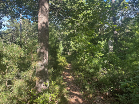 Cape Cod lies entirely within the southeastern Massachusetts pine barrens ecoregion, a globally rare habitat supporting a unique mix of plants and animals adapted to nutrient-poor soils and a variable climate. The region contains a diverse mosaic of habitats, including woodlands, forests, ponds, streams, wetlands, estuaries, salt marshes, dunes, beaches, and grasslands that support both common and rare species.
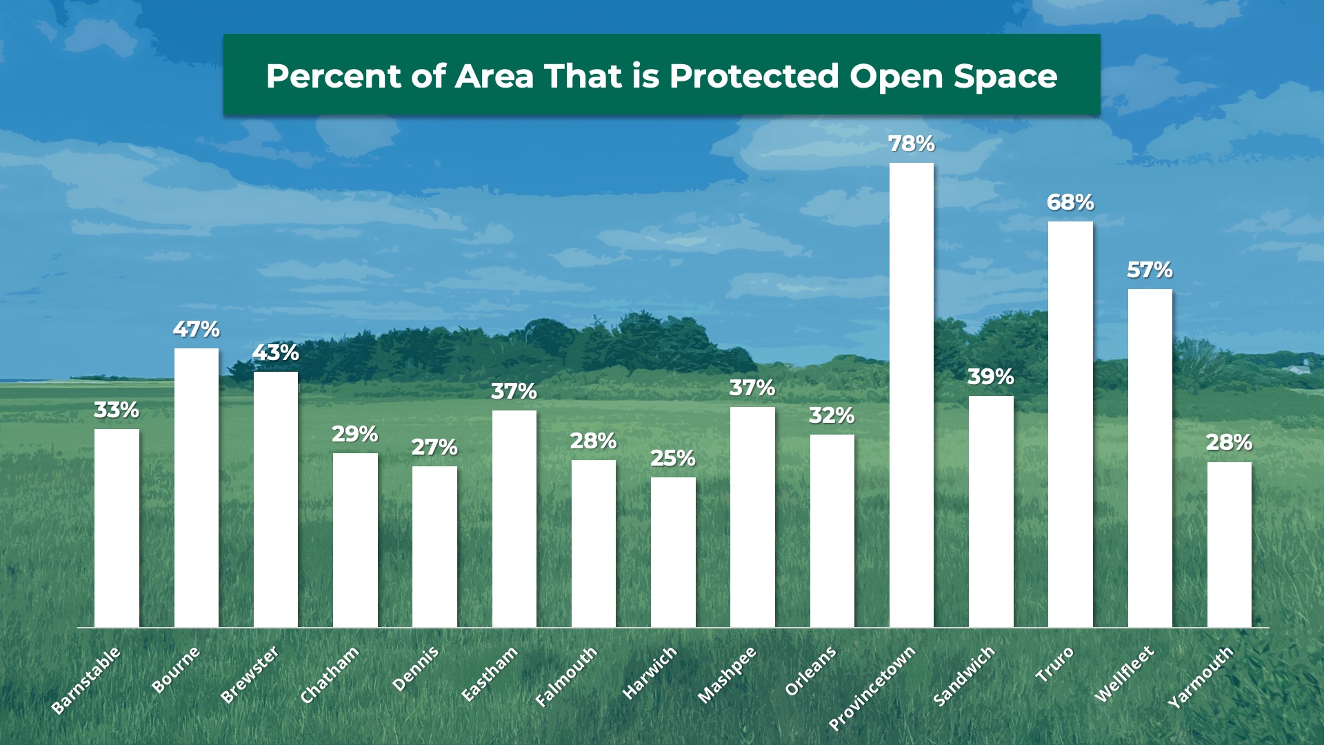
Approximately 40% of Cape Cod’s more than 230,000 assessed acres are protected open space. The protected land includes federal, state, and local holdings, which vary widely in their amounts by town. In total, Cape Cod towns hold more than 30,000 acres of protected open space. In addition to government entities, private land trusts have been crucial in protecting and stewarding open space.
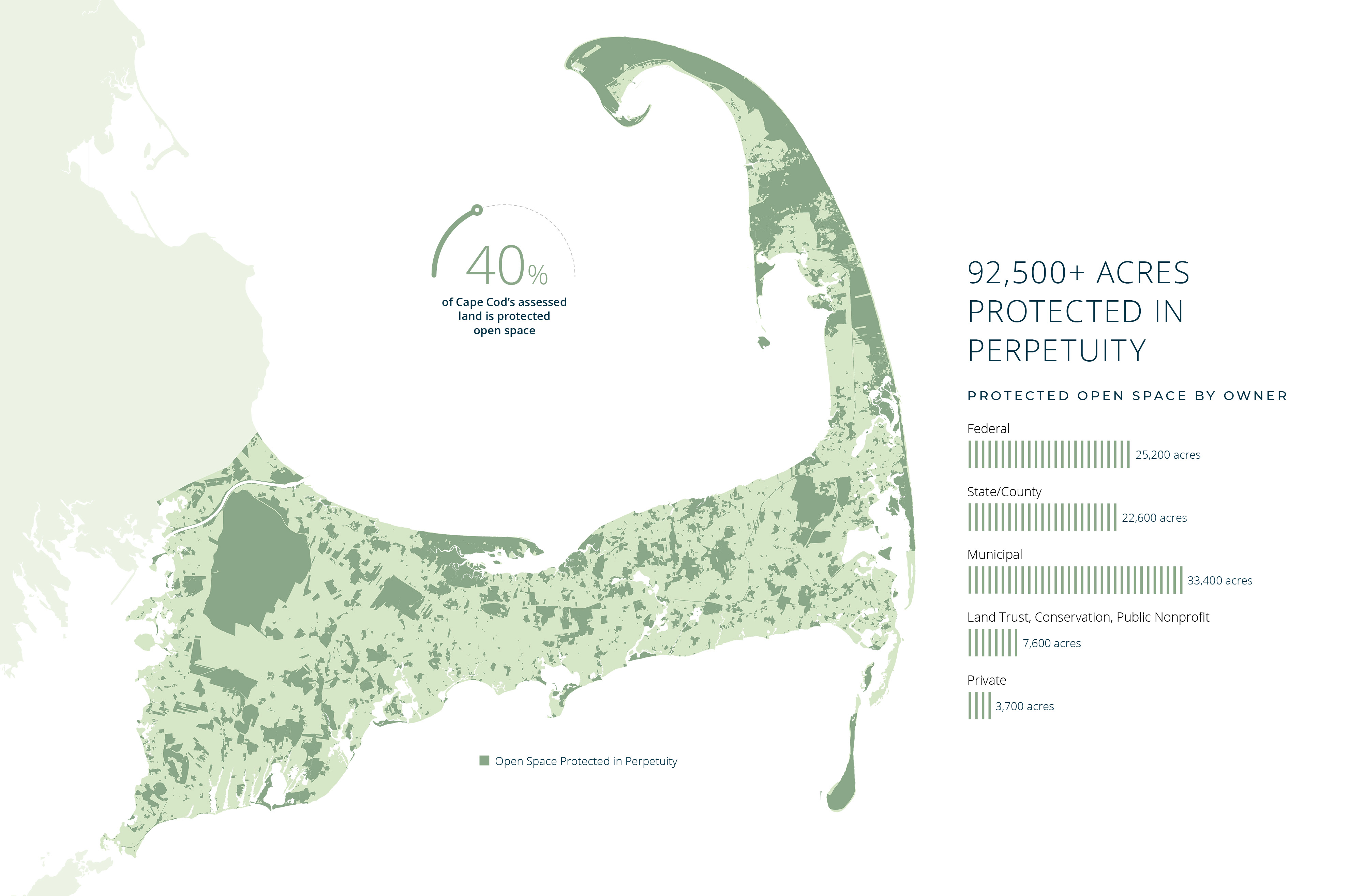
Explore the Regional Open Space Dashboard to learn about protected lands across Cape Cod.
Project Details & Background
Regional Policy Plan
The Regional Policy Plan (RPP) provides regional planning policies and objectives to guide development and protect the region’s resources. The plan includes a growth policy and contains regional goals. The Growth Policy for the region is to focus growth in centers of activity and areas supported by adequate infrastructure and guided away from areas that must be protected for ecological, historical or other reasons. Development should be responsive to context allowing for the restoration, preservation and protection of the Cape’s unique and finite resources while promoting economic, environmental, and community resilience.
Regional Policy Plan Open Space Goal
Conserve, preserve, or enhance a network of open space that contributes to the region's natural and community resources and systems.
Regional Policy Plan Recommendation: Develop a Regional Open Space Plan
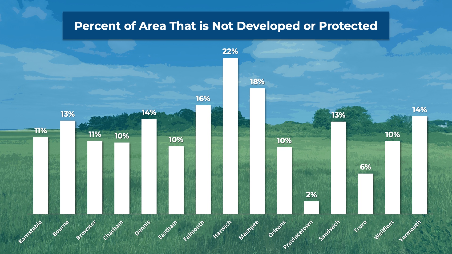
 With limited land left that isn't developed or protected, developing a regional open space plan is needed to prioritize resource protection, improve connectivity of open space, and identify lands of community significance.
Regional Priorities
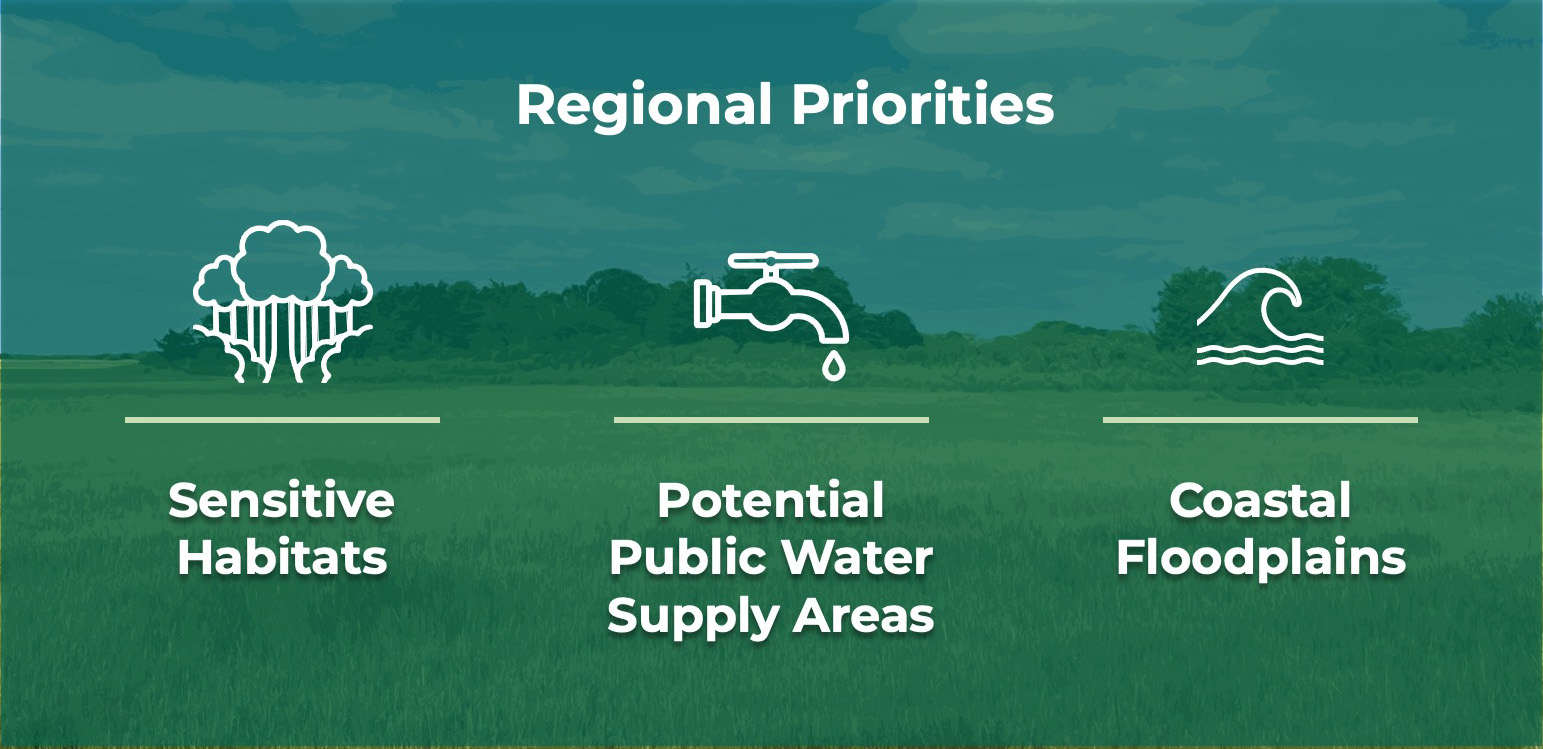
Through the RPP update planning process, stakeholders expressed priorities for open space protection, including protecting the region's sensitive habitats, public water supply areas, and coastal floodplains.
Project Framework
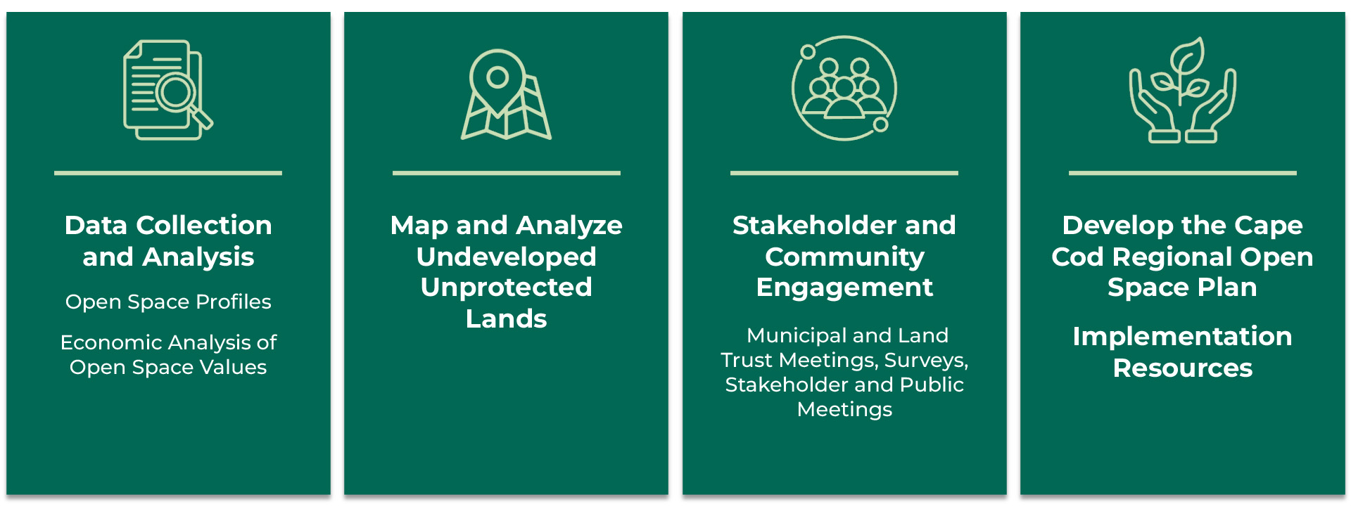
The Regional Open Space Plan process has begun with robust data collection and analysis, which will continue throughout the project. This includes developing Open Space profiles for each town as well as the County, which provide information on amounts and types of open space and protected and unprotected lands in each geography, as well as recent funding and acquisitions for open space. The process will also include further analysis of the undeveloped and unprotected lands in the region to inform prioritization of those areas for protection, as well as an economic analysis to better understand and communicate the value of open space and the importance of protecting it.
 Stakeholder Engagement
The Regional Open Space Plan will be informed by stakeholder and community engagement. To begin, this includes discussions with each town, federal and state partners, and land trusts throughout the region to understand current open space priorities, challenges, and tools and resources that would be helpful in advancing open space initiatives. A survey was conducted to gain broader input on open space priorities throughout the Cape. Further stakeholder and public meetings will guide and refine the plan. The planning process will also result in development of resources to support implementation by towns, non-profits, and others interested in advancing open space protection and stewardship priorities.
Resources
New: Open Space Profiles
Cape Cod Commission staff have developed open space profiles for each of Cape Cod's 15 towns and the County. Profiles provide data on land protection, opportunities for land preservation, and more. Click individual town names to view profiles. Click on the small map of Cape Cod in the upper left corner to view the County profile.